Hagere Selam (Hāgere Selam)
Hagere Selam (Amharic: ሀገረ ሰላም) is a town in southern Ethiopia. Located in the Sidama Zone of the Southern Nations, Nationalities and Peoples' Region (or kilil), this town has a latitude and longitude of 6.48333°N, 38.51667°W and an elevation between 2759 and 2829 meters above sea level.
This town has both telephone and postal service, and is supplied with electricity by the Ethiopian Electric Power Corporation from the national grid.
Hagere Selam was reportedly founded in 1907 by Dejazmach Balcha Safo, to serve as the capital of Sidamo Province. His court was described by John Boyes: "The apartment was large and handsomely appointed, the floor covered with Turkish carpets, and the ceiling composed of reed work of various colours in a circular design. Above the throne was a canopy, lined with red and draped with red curtains. The general kept his court with something like royal state."
Dejazmach Balcha soon left to govern Harar for three years, returning to Hagere Selam in 1916. Ras Desta Damtew in the 1930s moved the provincial capital to Irgalem after he became governor, because Irgalem was more conveniently situated on a motorable road.
Hagere Selam was occupied 11 December 1936 by a column of the Italian Laghi Division which advanced south from Aleta Wendo. The Italians renamed the town Hula, in order to avoid Amharic names. Within a few years the Guidi described the town as an important market for coffee, hides, and cattle. Amenities included the Vice residenza, telegraph, infirmary, restaurant, and spacci. Of the four churches in Hagere Selam, Kidane Mihret was the principal one followed by medhanialem,Silassie and Giorgyes. The Italians started construction of a mosque at this time. The town was retaken by elements of the British 11th (African) Division on 18 May 1941.
A station of the Norwegian Evangelical Mission NLM at Hagere Selam, founded in 1953, claimed around 1962 to be the Norwegian missionary station with the highest altitude.
Map - Hagere Selam (Hāgere Selam)
Map
Country - Ethiopia
 |
 |
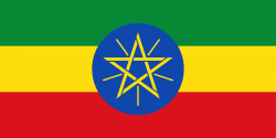
| Flag of Ethiopia | |
Anatomically modern humans emerged from modern-day Ethiopia and set out to the Near East and elsewhere in the Middle Paleolithic period. Southwestern Ethiopia has been proposed as a possible homeland of the Afroasiatic language family. In 980 BCE, the Kingdom of D'mt extended its realm over Eritrea and the northern region of Ethiopia, while the Kingdom of Aksum maintained a unified civilization in the region for 900 years. Christianity was embraced by the kingdom in 330, and Islam arrived by the first Hijra in 615. After the collapse of Aksum in 960, a variety of kingdoms, largely tribal confederations, existed in the land of Ethiopia. The Zagwe dynasty ruled the north-central parts until being overthrown by Yekuno Amlak in 1270, inaugurating the Ethiopian Empire and the Solomonic dynasty, claimed descent from the biblical Solomon and Queen of Sheba under their son Menelik I. By the 14th century, the empire grew in prestige through territorial expansion and fighting against adjacent territories; most notably, the Ethiopian–Adal War (1529–1543) contributed to fragmentation of the empire, which ultimately fell under a decentralization known as Zemene Mesafint in the mid-18th century. Emperor Tewodros II ended Zemene Mesafint at the beginning of his reign in 1855, marking the reunification and modernization of Ethiopia.
Currency / Language
| ISO | Currency | Symbol | Significant figures |
|---|---|---|---|
| ETB | Ethiopian birr | Br | 2 |
| ISO | Language |
|---|---|
| AM | Amharic language |
| EN | English language |
| OM | Oromo language |
| SO | Somali language |
| TI | Tigrinya language |


